
Before we examine the Gunpowder Watershed let's answer an essential question. What is a watershed?
A watershed is the boundary and basic hydrological unit that delimits a drainage basin. In the U.S. and Canada this term has come to be synonymous with the terms drainage basin and catchment. Thus, it has become common practice to use the term watershed loosely in order to refer to areas such as the "Chesapeake Bay Watershed" and one of its sub-watersheds the "Gunpowder Watershed." Each drainage basin has its own network of river and stream channels that drain water from and through that particular watershed. The characteristics of that drainage network play a great part in determining how water moves through the basin. However, this surface watershed may not correspond with the sub-surface movements of water.
Watersheds drain into one another. Thus, it is important to grasp the concept that individual drainage basins are not self-contained entities, they are parts of larger surrounding watersheds that represent only a small portion of the greater hydrologic cycle.
Here are explanations and illustrations to help you understand how watersheds are pieces that fit into the "big puzzle."
A watershed is part of the greater hydrologic cycle

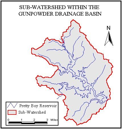
Watersheds form a nested hierarchy. It is mainly topography that determines where and how water flows from one area to the next. However, each large drainage basin can be broken into smaller drainage basins called sub-watersheds. The flow of water (and whatever it carries with it) is influenced by large features such as a continental divides, but one can also focus on drainage around an individual river. Thus, watersheds come in all shapes and sizes. This also means that each watershed has a sub-watershed. However, common sizes that are delineated are "eight, ten, and twelve digit" watersheds. This standardization improves mapping of drainage basins. Understanding scale and geomorphology is of utmost importance when studying "interconnectedness" of watersheds. In short, watershed analysis such as that provided on this web-site demonstrates how what we do in our watershed dramatically affects people and the environment "downstream" regardless of administrative borders, many times over long distances, and often on a very large scale.
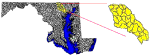
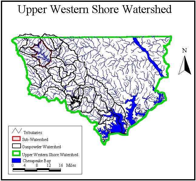
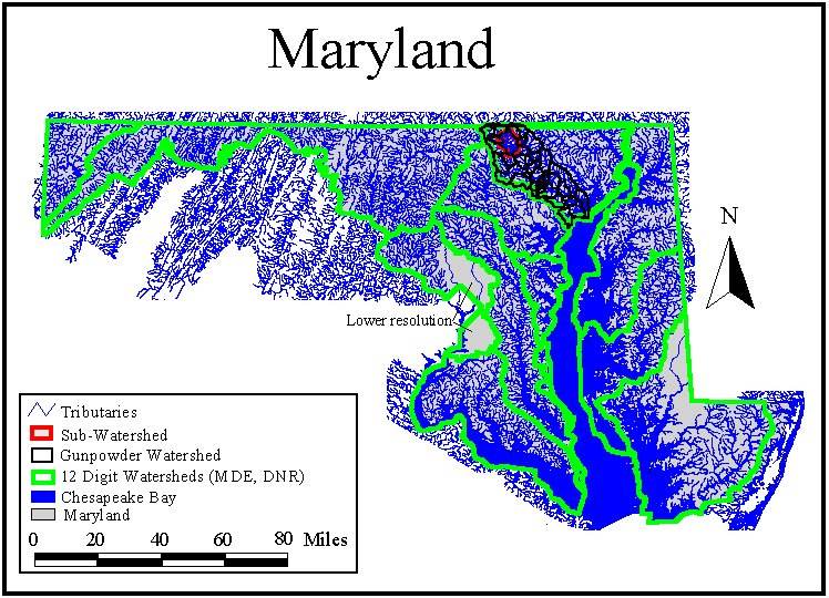
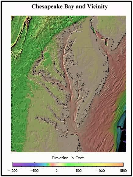
While contours on a topographic map may show where water will flow, it is easy to see that picking the size of a watershed to identify is somewhat subjective. For instance, the Gunpowder Watershed lies within the Upper Western Shore Watershed, which in turn resides within the Chesapeake Bay Watershed. Consequently, what happens in the Gunpowder affects the health of both the Upper Western Shore and the Chesapeake Bay. So does one say that he or she lives in the Gunpowder Watershed or the Chesapeake Bay Watershed? The most accurate answer is "both." To add to the confusion, the EPA has delineated somewhat different shaped watersheds for Maryland than the Maryland Department of Natural Resources. But do not be distracted by semantics and arguments concerning the finer points of watershed delineation. The point is that what happens in a given watershed has important consequences for the health of other watersheds. The series of maps below illustrate the "interconnectiveness" of watersheds.
Watersheds fit together like pieces of an interdependent puzzle
Warning: Although images have been compressed, some files are over 50 kb and may download slowly on older modems.
This next series of maps illustrates some aspects of the role that land forms and elevation play in the hydrologic cycle. Water carries away from continental divides to help form tributaries, water eventually passes on to large river basins (e.g. the Mississippi), these relatively low-lying basins funnel tremendous amounts of water towards the coast.
Gunpowder Watershed Clearinghouse |